|
|
|
CAPE HATTERAS, NORTH CAROLINA August 3, 2004 On Saturday July 31, 2004 we had out first tropical depression in the Atlantic for the 2004 season. Tropical Depression 1 formed from a mass of showers and thunderstorms that had been somewhat stationary for several days in the Bahamas. Slowly these showers and storms organized to become Tropical Storm Alex by 2pm on August 1st. Alex would move little for about 24 hours. A cold front was expected to move to the eastern seaboard and pick Alex up and quickly move it northeast and out to sea. Late in the afternoon of the second, Alex would start to move slowly to the north-northeast. As he did so, he would slowly begin to organize a little more and the sustained winds would increase to 60mph by the 5pm advisory. At that time the National Hurricane Center in Miami, Florida issued a hurricane warning for parts of the North Carolina coast including portions of the Outer Banks. As of the 5pm I left Portsmouth and Mark and John left Wilmington and Raleigh for Cape Hatteras. By now Alex was visible on radar out of Wilmington. It appeared as I drove south, Alex was really starting to get his act together. By 2am on the third, Alex would become the first hurricane of the season. We quickly got the gear ready for Alex's arrival and tried to get some sleep. By the time we got up around 7:30am Alex's forward speed had increased to 14mph to the north-northeast and maximum sustained winds had increased to 90mph. We quickly gathered our laptops and rain gear and headed out into the gusty winds that were already whipping the coastline and the outer rain bands that would periodically dump locally heavier rains. Mark had received an email from some fans of the site that said they lived just down the road from where we had stayed the night before and were welcome to use their Sprint DSL line to send the images and reports to HurricaneTrack.com. Mark graciously excepted the offer. As Mark and John quickly setup the connection, I drove a bit north on Hwy. 12 to shoot some video and photos of people that were leaving the island. I stopped right in front of the area of Hwy. 12 that washed away during Hurricane Isabel in 2003. As the winds and rain increased, Hwy. 12 was already starting to flood from the rainfall. I drove back to the house and found a road just across the street that was higher in elevation. Most of the locals in the village were bringing their vehicles to the road to protect them from what storm surge Alex may cause. By now it was obvious Alex had not moved to the east as much as everyone had hoped and the western eyewall was poised to cross the Outer Banks as he turned to the northeast. By 1pm Alex had become a category 2 hurricane with winds sustained near 100mph. There was now a 2-5 foot storm surge threat from the Pamlico Sound. This threat would hold true as Alex's eyewall crossed the coast and the winds switched direction as the eye pulled northeast. Around 11:40am I recorded a 55mph wind gust on my vehicle with a barometric pressure dropping to 994mb. The barometric pressure bottomed out around 12:45 near 986.1 with a wind gust of 68mph. As the backside of the eyewall started moving back off the coast and the pressures rose, at 1:45pm I had my first hurricane force gust of 74mph. Just a few minutes later at 2:01pm it reached 78mph and at 2:02pm I had a peak gust of 92mph with a barometric pressure of 992mb. Near the same time frame, Mark and John road up the road toward the sound and recorded a 105mph gust and a 102mph gust on the Tahoe. Below are the photos and video clips from our encounter with Hurricane Alex. Youtube video of Hurricane Alex
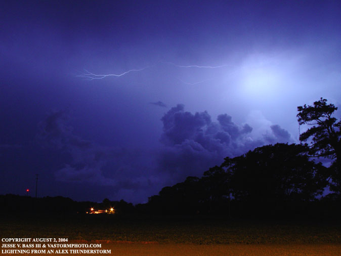
On the way down to the Outer Banks there were several thunderstorms that had moved inland from Alex's outer rain bands. I managed to get one lightning photo along Rt. 158 south.
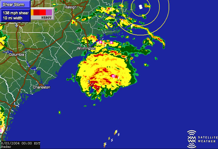
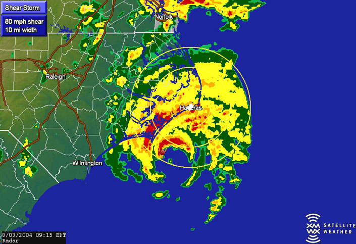
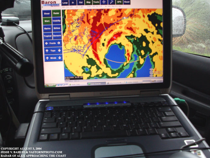
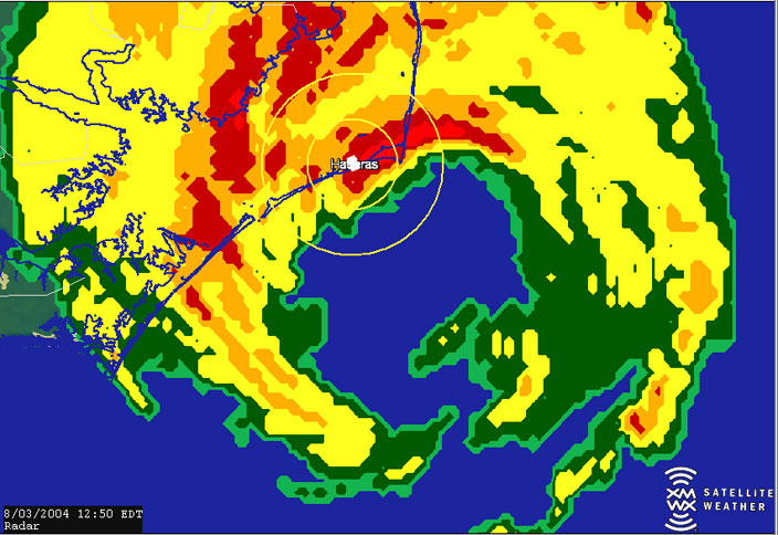
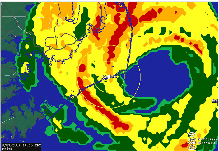
Once I reached the Outer Banks I fired up the Mobile Threat Net to watch Alex as he moved north. In this screen shot you can see several shear markers indicating possible vortices or tornados in the eyewall. As you can see there was one indicating possibly 138mph shear.
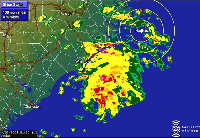
Another one showed up as the radar images showed that Alex's eyewall may have been intensifying.
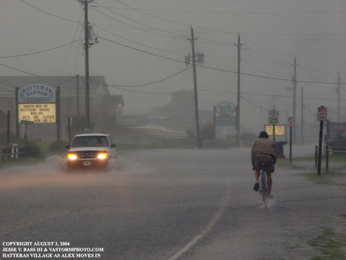
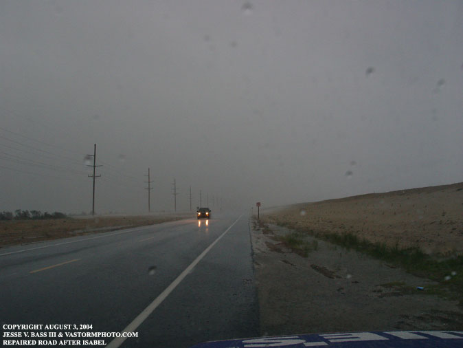
Early in the morning of August 3rd, you can see how the heavy rains had already started to flood Hwy. 12. The guy on the bike was pedaling against some 25-30mph gusts.
Looking north along Hwy. 12, this is the
area that washed out during Hurricane Isabel less than a year ago. We
were hoping that this patch of road would remain intact after Alex passed us
by. In this video clip you can see people headed north to make way for
Hurricane Alex.
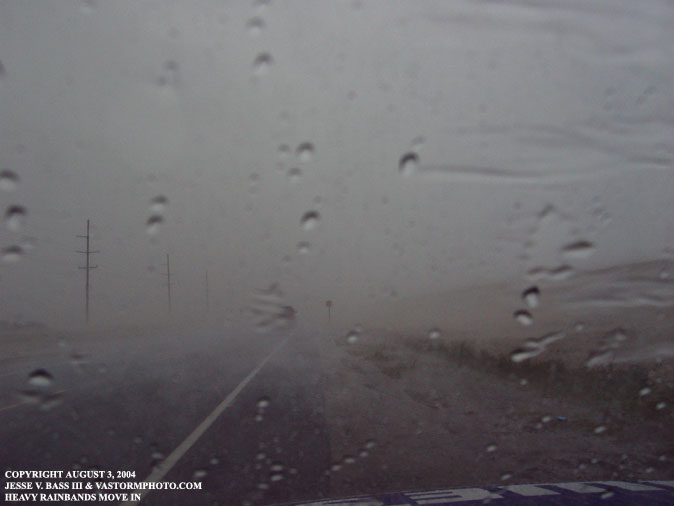
In just a matter of seconds, a heavier
rain stated falling and didn't let up much until the event was over.
In this shot you can see that heavy band as pushed inland from the southeast.
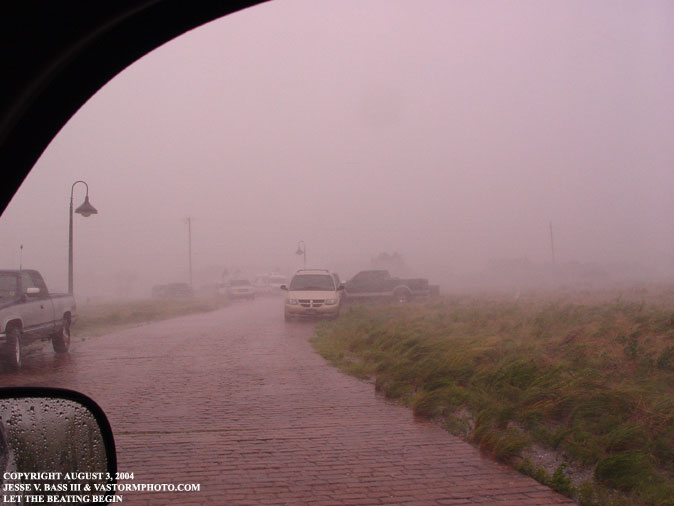
With the eye quickly approaching I headed
back southward to find higher ground.
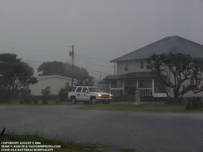
Looking across the street at the house where Mark was using the DSL connection, there was a flooded roadway between us as Alex approached.
A shot of the HP on the Joto desk running the Mobile Threat Net with Alex closing in.
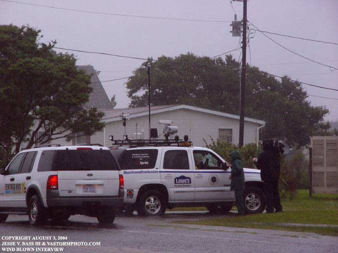
After getting the connection hooked up and
sending back updates to HurricaneTrack, Mark and John were interviewed by a
Raleigh TV station, WRAL I believe, about what we could expect from Cat. 2
Alex.
The palms begin their hurricane dance as
the wind approached 35-40mph gusts.
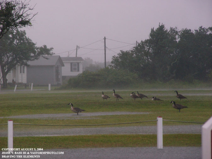
Facing into the wind, these geese were taking tropical storm force gusts full force. Many people say "This weather is for the birds." Well, there you have it.
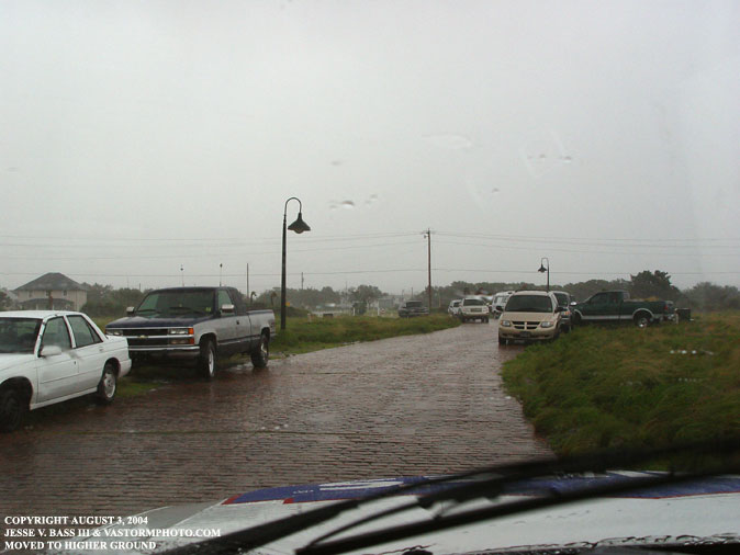
This shot was taken at the top of the road
where the locals came to park their vehicles to get them away from the storm
surge.
Within minutes, Alex had arrived and the
wind was blowing at about 40-45mph sustained.
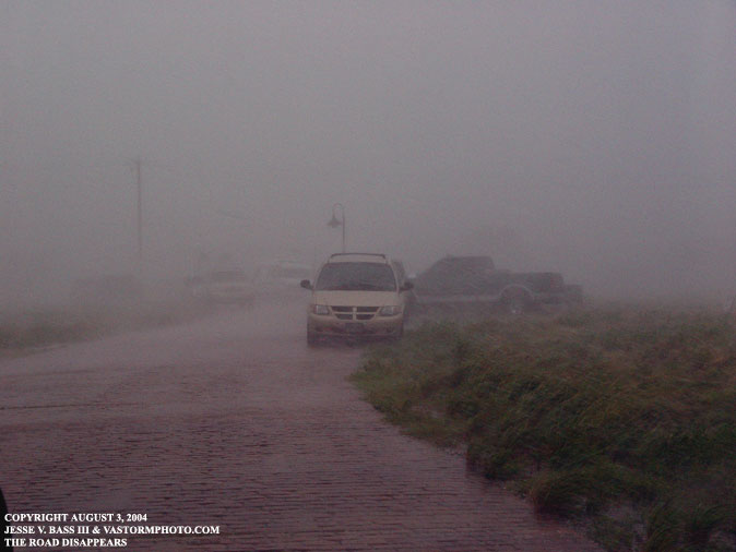
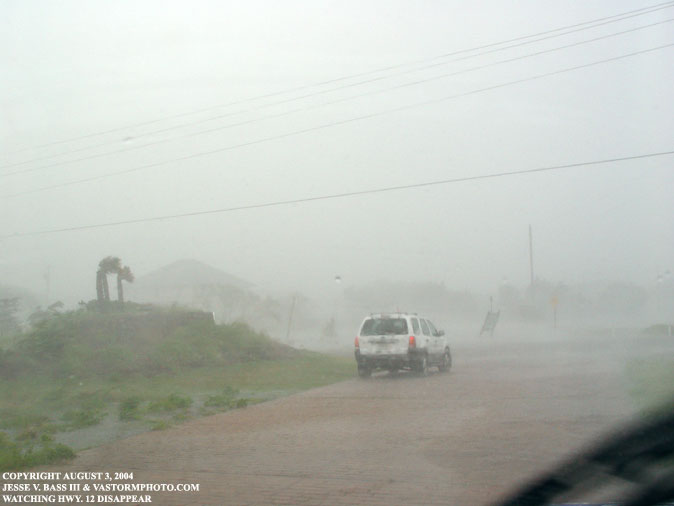
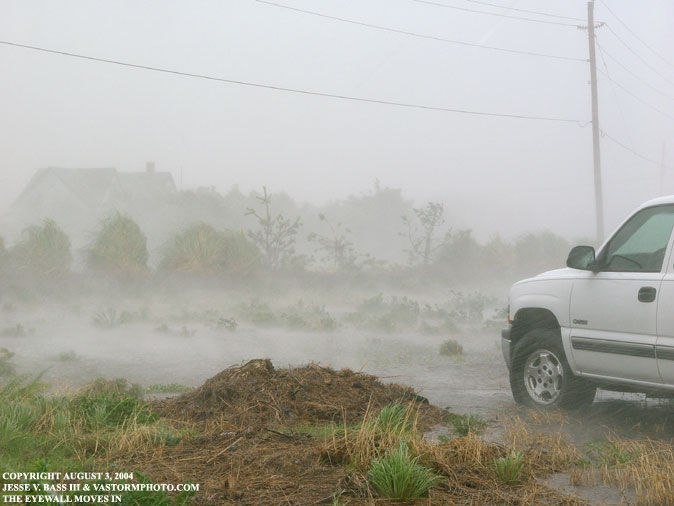
As Alex's eyewall slammed ashore the wind and rains really
started to pick up in intensity. Here the horizontal rain almost made
the road disappear.
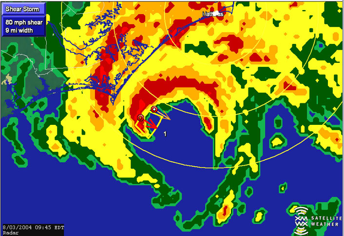
It was evident by looking at the radar why the winds and rain had increased. Alex's western eyewall passed right over us in Hatteras Village.
Now we were starting to see Alex's true form. The
winds would continue to increase from here. I would record a 68mph gust
just minutes after this photo was taken.
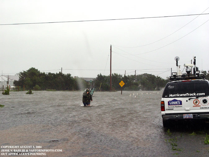
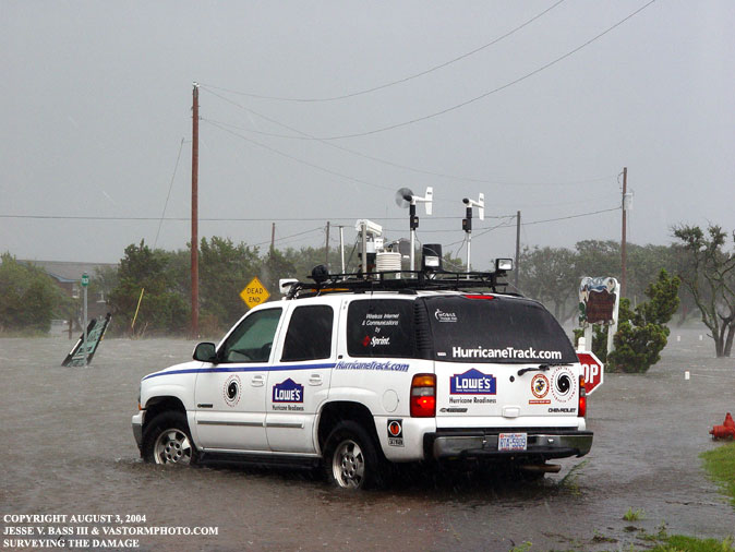
This SUV is a news truck from Noefolk, Va. WTKR a CBS
station stopped to film the wind, rain and rising waters on Hwy. 12.
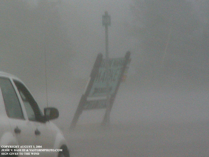
This sign was starting to give in to Alex's storng winds.
After a brief lull in the strong winds and rain, the eyewall
started to move back through our position in Hatteras Village. This time
we would sustain winds in the 70's for about 15-20 minutes.
Here the eyewall was pulling back north-northeastward.
The wind had switched and was coming from the northwest. This would blow
the Pamlico Sound inland over Hwy. 12 and would also be the point where we
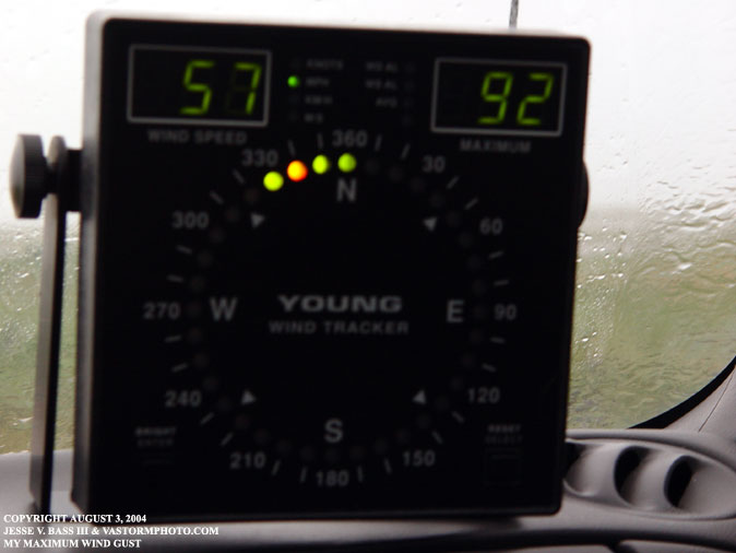
would record our highest wind gusts.
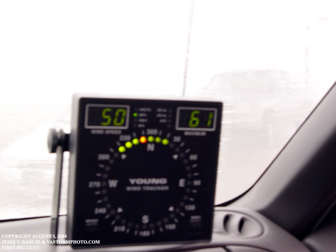
This was my highest wind gust of the day. Mark would
get a 105 and a 102mph gust just minutes later at the top of the roadway
closer to the sound.
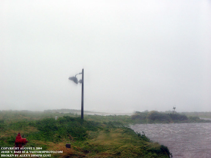
Back up the road closer to the sound side, we saw a light
swinging in the wind as it had been broken in Alex's 105mph gust. You
can see the storm surge washing in. Back down near Hwy. 12, the water
level was about 2-5 feet.
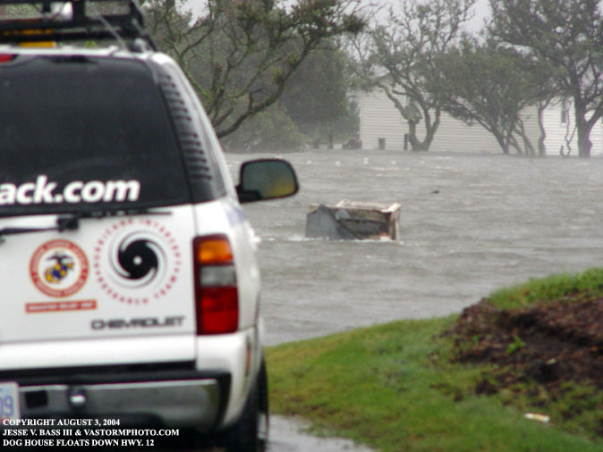
At some point during the storm a dog house or what appeared to be a dog house floated down Hwy. 12 and got hung up on a wire fence underwater across the street.
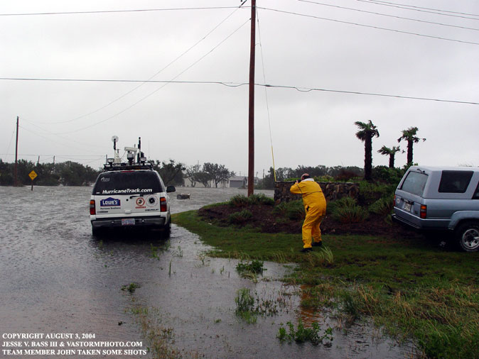
As the rain quit and the winds started to die down team member John hops out of the Tahoe for a quick shot.
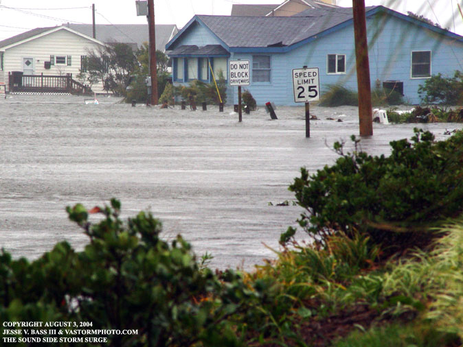
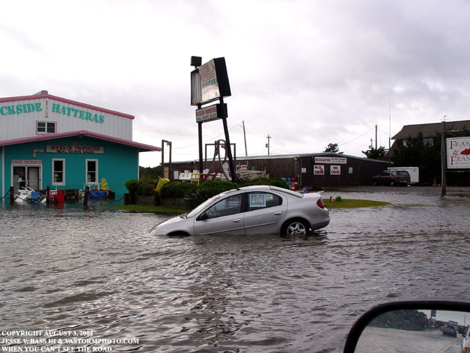
The storm surge was impressive to see. The water level had risen several feet in a matter of minutes during the height of the storm.
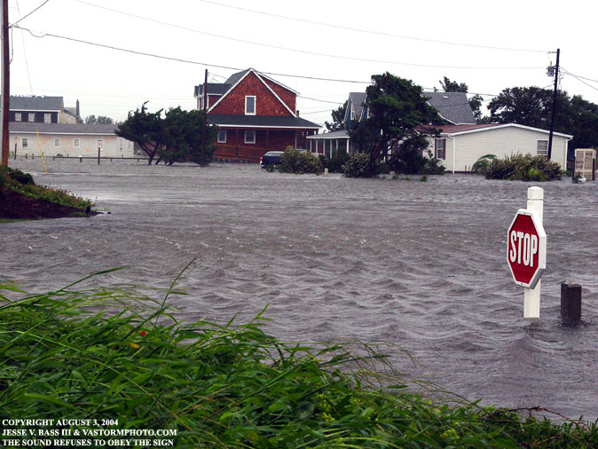
Right near the speed limit sign is one area where the storm surge inundated Hwy. 12. Alex disobeyed the speed limit as well. This is looking south down Hwy. 12.
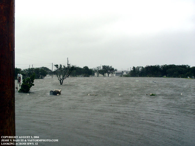
Looking north up Hwy. 12. for as far as we could see there was nothing but water.
In the left hand side of this photo is the house Mark was using the DSL connection. The Harrisons still had some repairs to make to the house after Hurricane Isabel in '03.
One of their sons came out after the storm to tell Mark that
they now had about a foot of water on the first floor of their home.
Another gentleman came up to check on his truck to see how well it
faired. He stopped and asked a few questions about the winds and I asked
him a question:
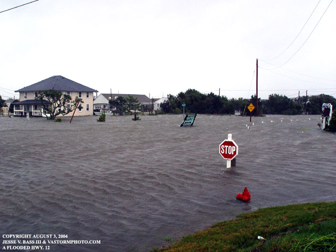
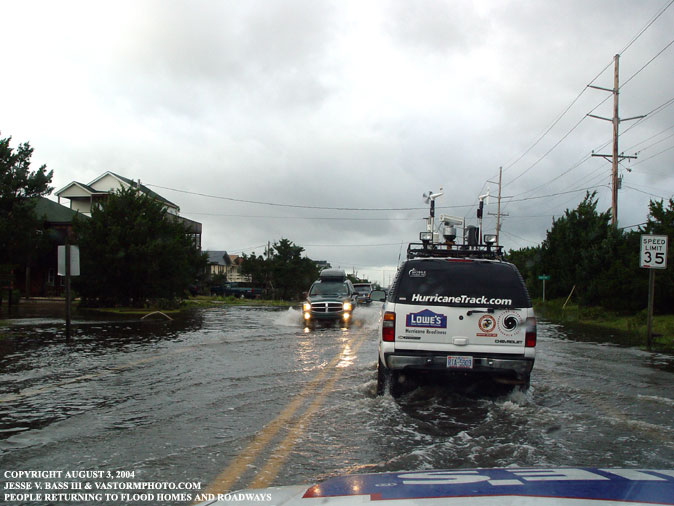
Looking north up Hwy. 12 we were waiting for the water to recede before we headed home and cleared the area before the emergency crews and electrical crews moved in to start the clean up.
This was an all to familiar sight as we headed north.
Flooded businesses, homes and vehicles all the way up Hwy. 12.
People returning from shelters and perhaps the Nags Head area to see how much damaged they may have sustained.
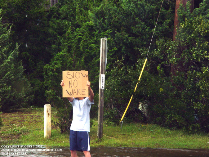
A young man stands in the street with this sign trying to get the point across to people to slow down. If you are a boater this is a familiar sign!
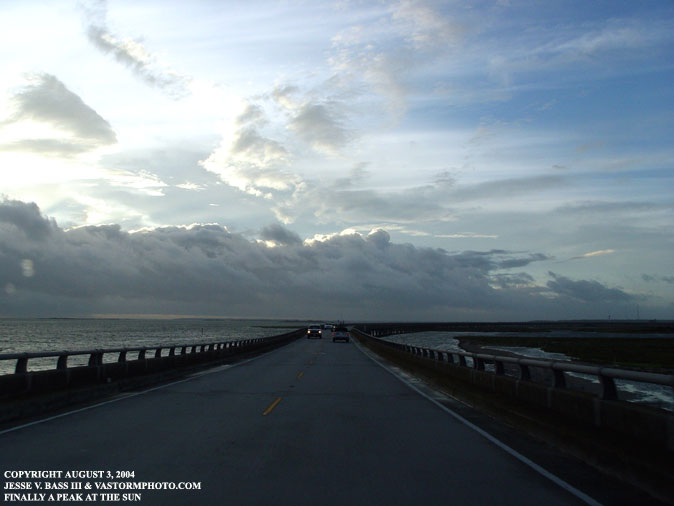
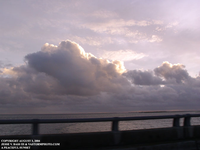
As we reached the Boner Bridge that links Hatteras to Nags Head, you could see some blue sky overhead. As we drove into Nags Head and the Kill Devil Hills area, it did not appear that there had been a hurricane moving through the region just a few hours earlier.
Even a hint of sunshine reflecting on the clouds could be seen. Things were starting to look up for the residents and vacationers of the Outer Banks. Now the long process begins of the clean up efforts. This was the second category 2 hurricane to strike the region in less than a years time. The damage was not as extensive as Isabel's in September. Alex was a glancing blow and Isabel crossed the coast moving inland from the southwest. The strongest winds from Alex remained offshore in the right front quadrant. Had that come ashore, there is no telling how bad the damage COULD have been. Everyone we talked to after the storm talked about the differences in the two storms. Isabel had an ocean side storm surge with huge waves that battered the coast for hours and destroyed many businesses and homes. Alex's surge was from the Pamlico Sound which is shallower water and the waves did not have time to build to large. That is the saving grace for the folks in Hatteras. What was sad to see is how no one really prepared for the storm. When we drove into town Monday night, there was not one single piece of plywood or storm shutters on any windows that we could see. You should never under estimate the ability of a tropical system over the Gulf Stream waters. The hardest thing for the forecasters to predict is the intensity. Alex proved just how difficult that can be. Hopefully next time the residents will be ready for whatever mother nature throws at them.
|