|
|
|
HURRICANE ARTHUR HITS THE OUTER BANKS July 3-4, 2014 As the July 4th holiday approached, the beaches along the east coast were slammed with tourists ready for the long holiday weekend. Lots of areas were booked up for the entire week ready to have fun in the Atlantic waters and in the hot late June early July sun. However, mother nature had other plans instore for the southeast coast. On or around June 25th, the National Hurricane Center began mentioning the possibility of a tropical system developing in the southwest Atlantic. The European model also known as the ECMWF, had been showing the system moving off the southeast coast of the United States and stalling off the coast and then developing into what would be Arthur. Well, on June 27th the low developed and pushed its way off the coast into the Atlantic. By July 1st the NHC would start advisories on tropical depression 1 of the Florida east coast as the depression had been drifting slowly southward. Through the day on July 1st, the depression would organize even further and become tropical storm Arthur later in the day. It was being forecast to make a turn northwestward and then northward over the next few days bringing it very close to or over the Outer Banks of North Carolina on or before July 4th. By July 2nd, windshear in the area had begun to relax and it would seem that Arthur was off to the races, developing at a steady rate and reaching 70mph. By July 3rd the Hurricane Hunters flew through Arthur and determined it had become the seasons first hurricane as it had started to move northward towards the North Carolina coast. The forecasts were calling for Arthur to possibly become a strong cat 1 or cat 2 hurricane as it passed the Outer Banks. Mark Sudduth and I would leave early in the morning of the 3rd to get to Hatteras Island before the closing of the Bonner Bridge at 5am and the mandatory evacuations begun. Mark got down sometime around the 3am 3:30 time and I rolled through at about 4am making down onto the island before the authorities closed the bridge to southbound traffic. Since it was the holiday weekend, there were no rooms available pretty much anywhere ahead of our arrival, yet a friend and follower of www.hurricanetrack.com for many years called Mark and offered up his cottage near the Rodanthe Pier. So at least we had a place to "work out of" leading up to the storm. Evacuation traffic was steady and fairly heavy at times as people headed north to Nags Head and the Kitty Hawk areas or even heading out of the Outer Banks altogether. Evan at 4am in the morning the amount of traffic on Hwy. 12 heading north was the most I'd ever seen at that time of morning. Arthur would continue to develop throughout the day and began to develop an eye on satellite and would eventually strengthen to become a cat 2 hurricane with winds near 100mph in the eyewall surrounding the eye. The forecast track would be off shore and the eye missing the Outer banks altogether in the morning of the third, to by evening that same day, making landfall somewhere along the chain of barrier islands. Watching these changing conditions Mark and I would start making plans on areas to set up some of our streaming cams, and other cameras along the island chain. We put several down in Hatteras Village at the home of the Harrison's who have been dealing with these storms and us for many years. They are a great family and have always been great in offering up their home and business to us to put any equipment we wanted to on their front porch to capture whatever the hurricane threw at us. We had meteorological equipment set up at the cottage in Rodanthe, cameras at the Harrison's in Hatteras Village and equipment on the Chevy Tahoe of Marks ready to go. With a storm surge of 3-5 feet above ground expected I decided I would not stay on the island as the hurricane approached later the evening of the third. I would head north and cover it from the northern Outer Banks. The chance of flooding my vehicle was to great along Hwy. 12 as its the only road on and off the island and the highway floods in heavy rains let alone a cat2. We would be working with the Weather Channel on this hurricane and Mark would do live shots and phoners with Jim Cantore and the crew back in Atlanta through the storm. Jim would even help Mark place the Floating Surge Cam out live on TWC just before Mark headed north to the Bonner Bridge to get into the eye as Arthur had made landfall between Cape Lookout and Beaufort North Carolina. Tracking across the Pamlico Sound Arthur would bottom out with a minimum central pressure of around 973mbs. But the track would not bring the eye over the Rodanthe area but to its west, so Mark headed north to to collect data from the eyewall and the eye if possible. He recorded an 81mph gust from the eyewall before he drove into the eye somewhere on the Bonner. I would drive southward from Kitty Hawk to get into the eye briefly before the winds switched and picked back up. However, I was in the northern area of the eye so I drove further southward and into the eye where it was calm and no rain as I approached the entrance to Hwy.12 along Bodie Island. Then the backside slammed me and birds that had been resting from fighting the wind were all along the road one flew up into the wind and slammed into my vehicles windshield. It didn't break it but I'm sure the seagull didn't fair as well I'm afraid. Knowing that the sound would be rushing back in I decided to turn around and head back north before it over took my vehicle and I lost a window because of another bird or some other debris. It was that horrible blue sky of very early morning that just seems to make it even harder to see than pure darkness so thought it would be best to get to an area safer than the stretch of Hwy. 12 I was on. Mark got caught north of the Lego Bridge there in Pea Island where hurricane Irene had cut a new inlet a few years ago and couldn't get back to the cottage in Rodanthe. He shot some incredible footage of the surge coming in along that portion of 12 before he decided to cross the Bonner and get into Nags Head. He also told me that the area I was in along Bodie Island where I had the run in with the seagull had about 3-5 of surge on it at one point before it started to recede. He lost his rear window of the Tahoe to some sort of debris whether it was a bird or something else being tossed into the wind. You can read his account at http://hurricanetrack.com/2014/07/07/hurricane-arthur-a-success-story-for-the-science/ . So below are some photos I took through the day of July 3rd before Arthur came ashore and before I headed out of the Hatteras Island area and back to Nags Head. I still have video to go through and see if there is really anything worth editing since it was a night time landfall. VIDEO: To come
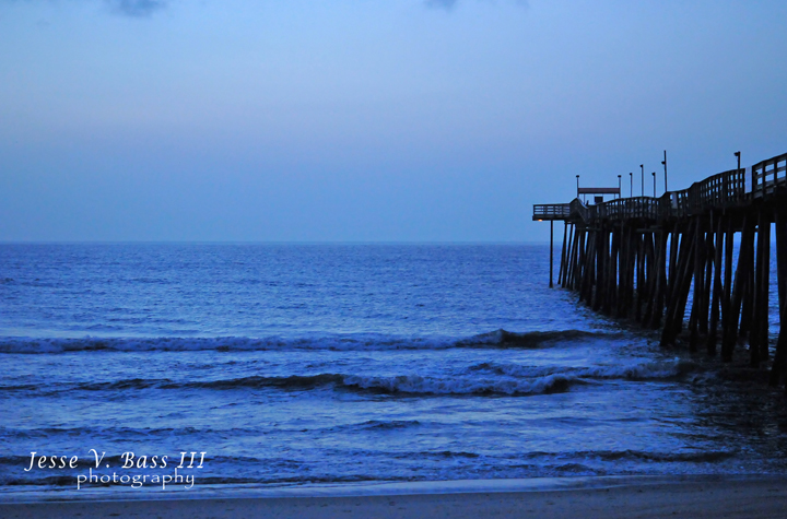
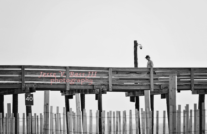
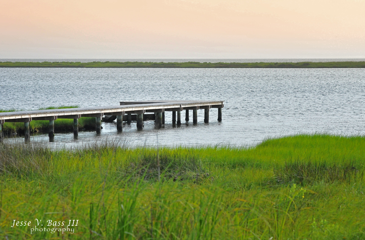
Early morning along the Rodanthe Pier on July 3, 2014.
Sunrise along the Rodanthe Pier.
Looking northwest at the beautiful sky in the early morning hours of July 3rd.
More from Rodanthe Pier as the sun rose and arthur lurked offshore.
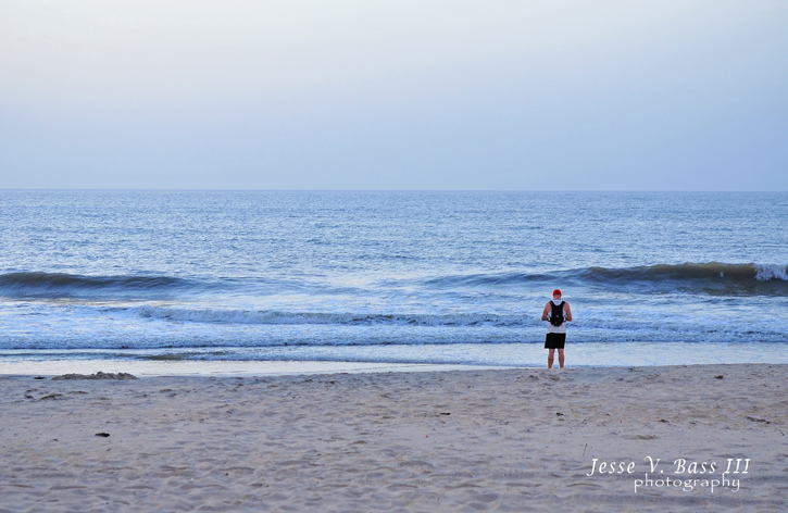
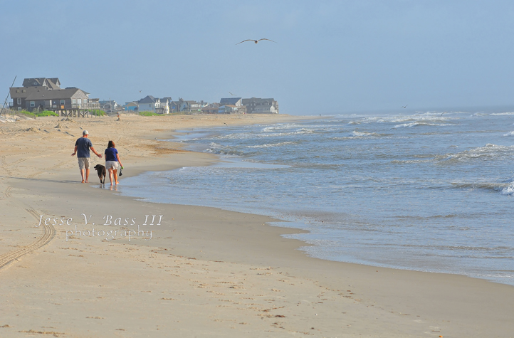
Even as evacuations were under way, some people were still out for their early morning exercise on the beach.
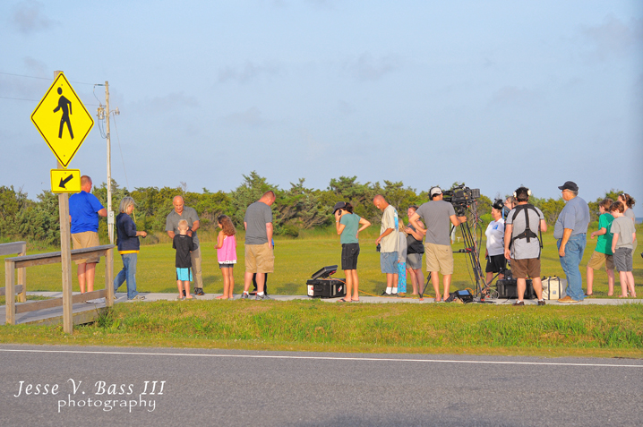
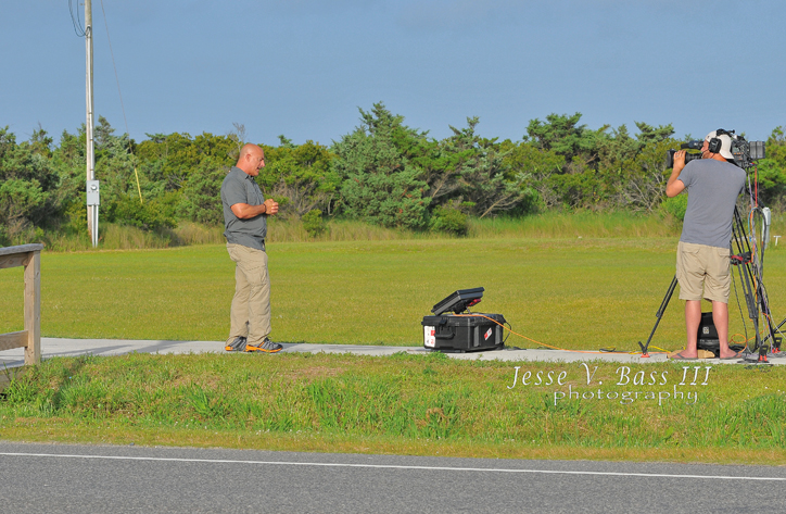
Along Hwy. 12 people were stopping on their way north to see Jim Cantore from The Weather Channel in the early morning of July 3rd.
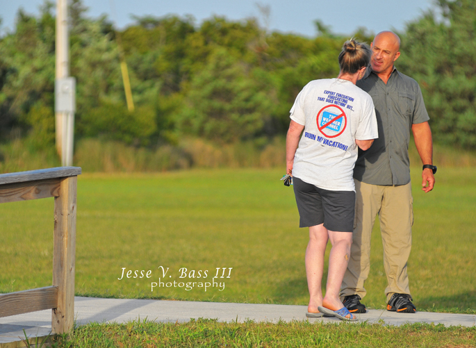
This lady showed off a shirt she had made that basically says that The Weather Channel ruined her vacation. LOL.
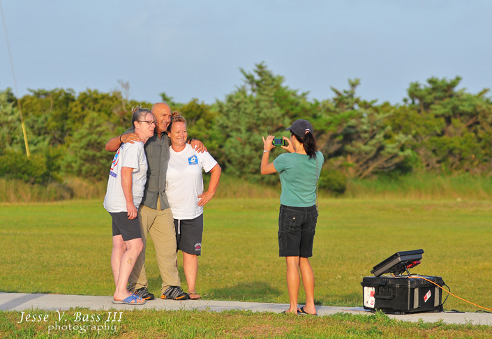
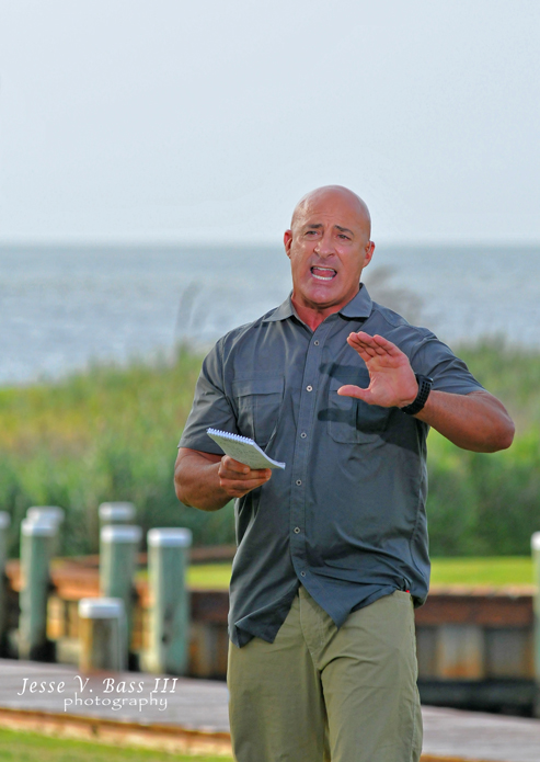
Photo op with the man Jim Cantore along Hwy. 12.
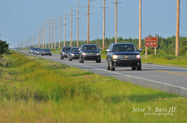
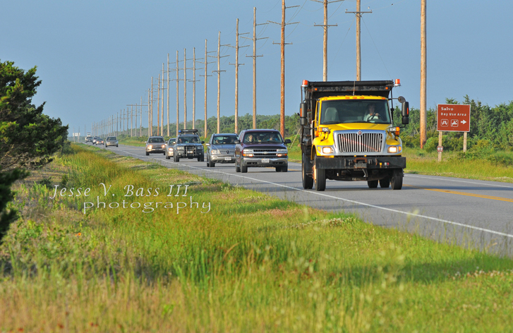
Evacuation traffic was steady heading north off of Hatteras Island all day.
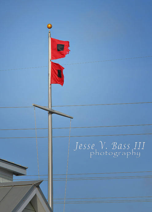
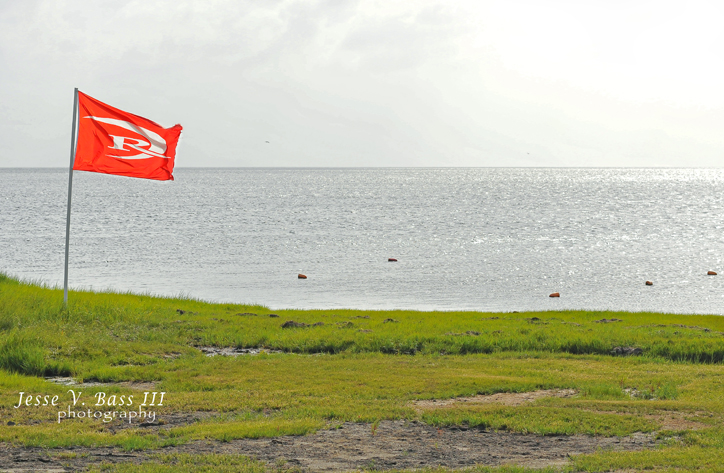
Hurricane flags flying in the wind along Hwy. 12 ahead of Arthur's arrival.
Most of the people had moved on as Jim went back live in the early morning hours of July 3rd.
Someone on the Rodanthe Pier securing trash cans and other furniture and objects on the pier so they didn't become projectiles in Arthur's 100mph winds. Vacant beaches along the Outer Banks on the July 4th holiday? Arthur ran most off the beaches for good reason.
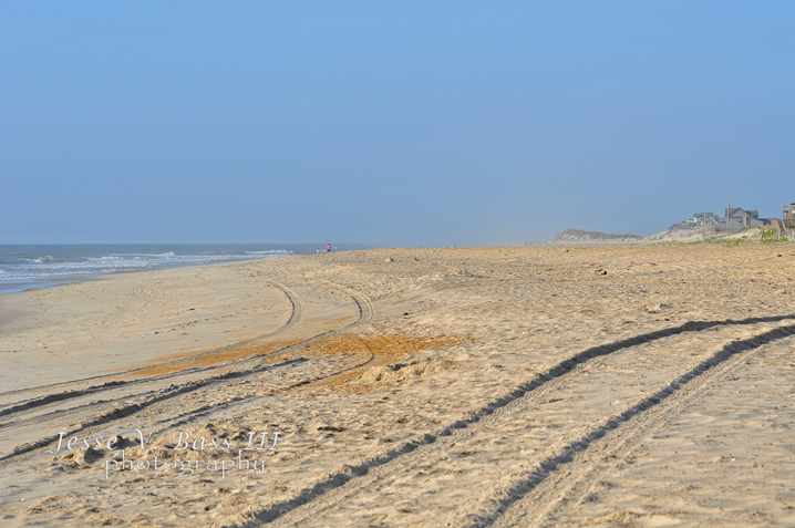
Either a few locals or vacationers that waited to leave went out for an early morning stroll on the beach as it was mostly a beautiful day with clear skies and warm temps.
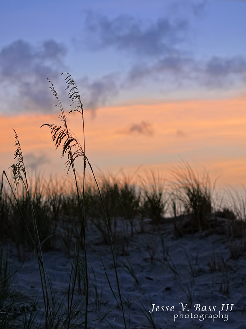
The peaceful and tranquil beach before a cat2 hurricane in Rodanthe.
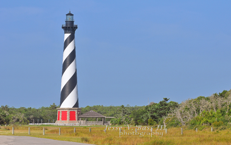
The well known Cape Hatteras Lighthouse in Buxton, NC. not excepting tourists today, even as the wind was light and sunny skies overhead.
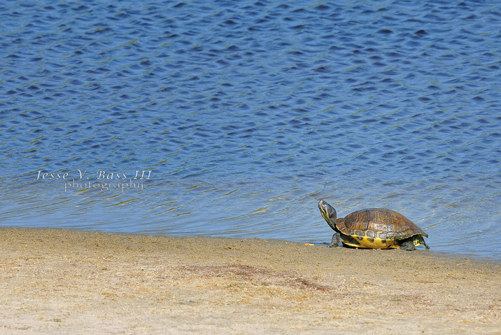
A turtle sunnin' himself in the morning sun without any worry of hurricane Arthur near the Cape Hatteras Lighthouse in Buxton.
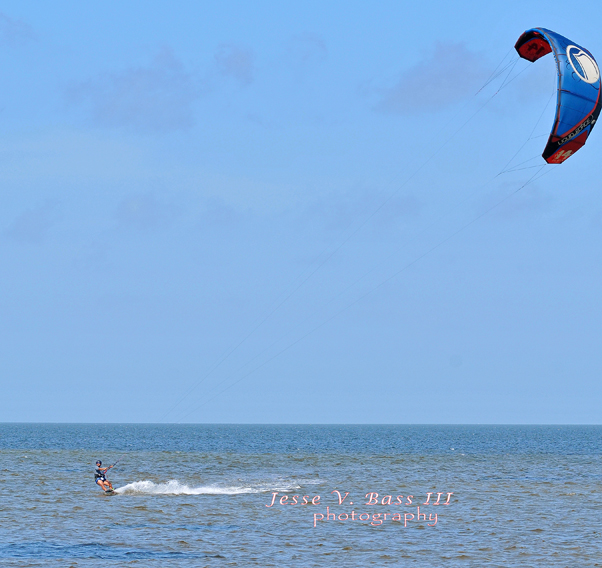
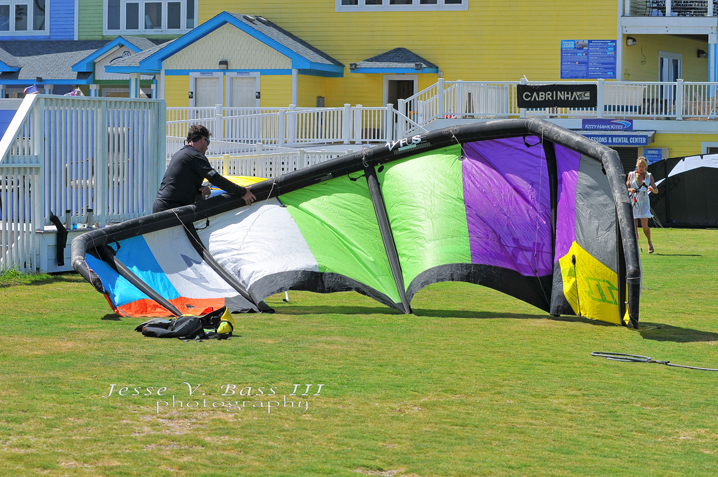
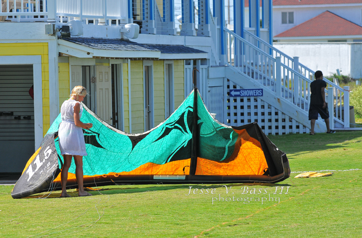
As the afternoon drew closer the winds began to increase as Arthur pushed northward. And the kite boarders didn't hesitate. they found great conditions as they surfed the Pamlico Sound.
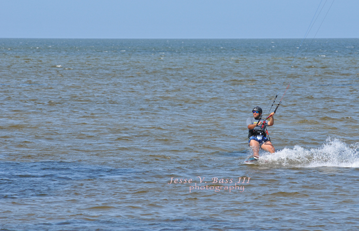
More kite surfers male and female preparing to enjoy the strengthening winds over the Pamlico Sound as Arthur strengthened and made his way towards the Outer Banks.
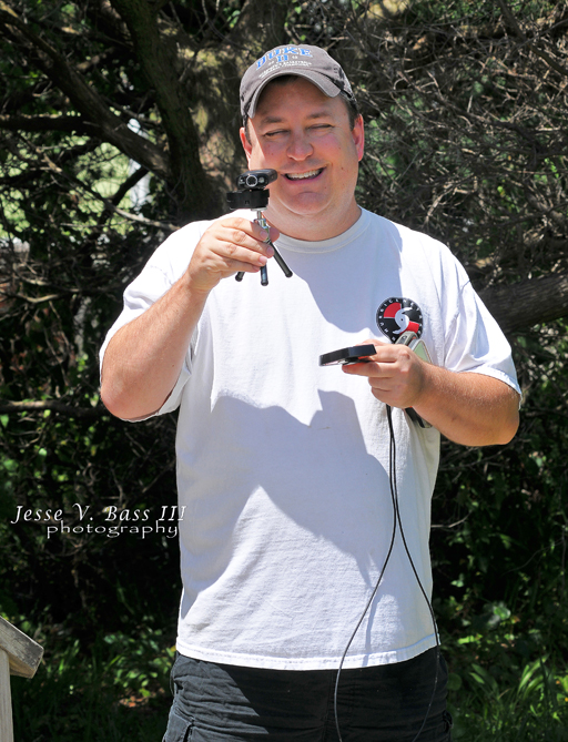
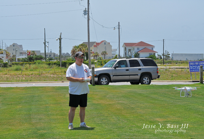
Mark Sudduth holding his streaming cam to show everyone watching, me.
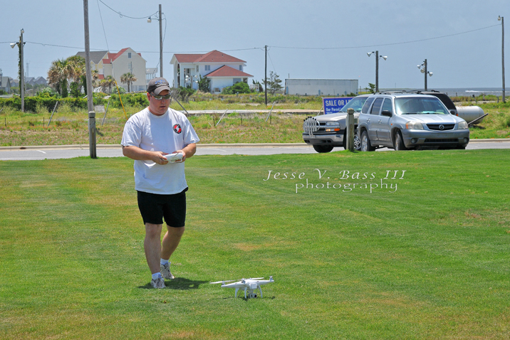
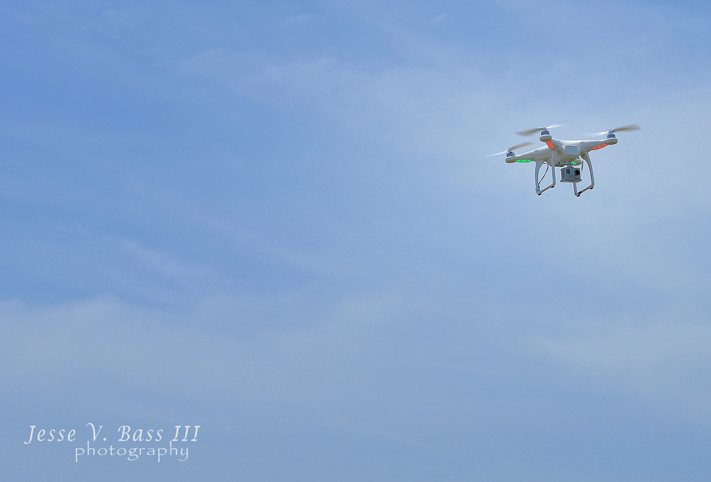
Mark getting ready to fly the quadcopter over Hwy.12 to get footage that would later air on The weather Channel of some of the evacuation traffic and really how empty Hwy.12 had become at this point.
Lift off!
High above Hwy.12 in Rodanthe. NC shooting video.
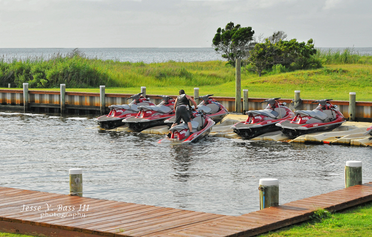
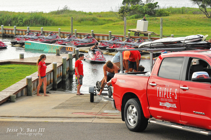
Beginning to bring in jet skies and other objects out of the Pamlico Sound ahead of Arthur.
Working hard to secure everything before the storm hit and the sun went down.
More preparation taking place to secure everything possible and get it to dry land.
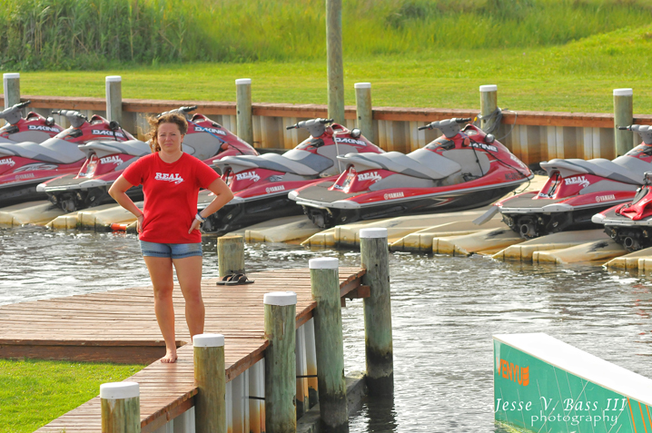
This young lady was waiting in the hot, humid afternoon sun for the next vehicle and trailer to back down the ramp.
Looking out over the Pamlico Sound as the clouds began to build quickly and a stiff breezy continued to increase as the sun started to set.
Another shot in the ate afternoon hours looking off in Arthur's direction over the Pamlico.
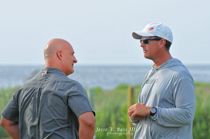
Jim Cantore talking to a gentleman about the preparations that his business was taking before the hurricane.
Big Jim doing a live shot discussing the possible amount of storm surge that could inundate the area later as Arthur crossed the area.
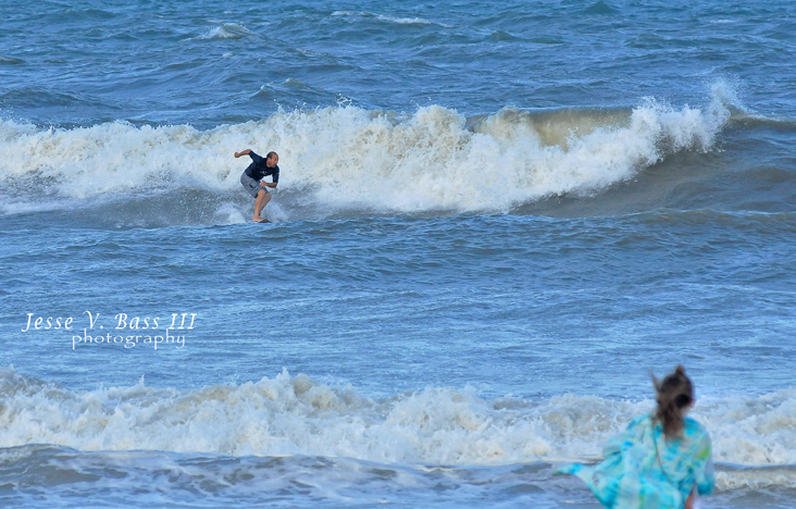
A surfer taking advantage of the increasing waves as Arthur drew closer and before the sun went down on the evening of July 3rd at the Rodanthe Pier.
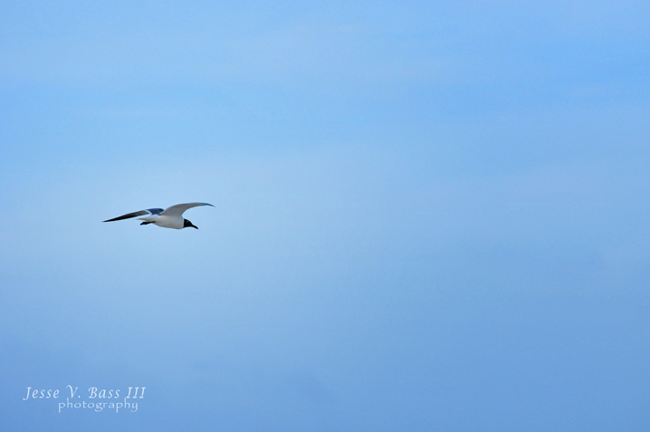
Seagull hovering in the wind at the pier in Rodanthe in the fading sun and increasing clouds and wind. Some of the outer bands were already pushing inland in Hatteras Village.
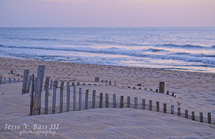
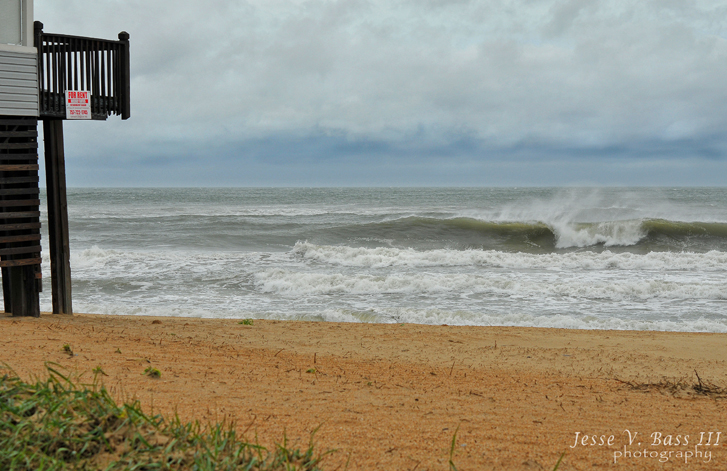
Early morning on July 4th in Kitty Hawk after Arthur had pushed offshore. The ocean was starting to calm quickly with some offshore winds. All Images Copyright Jesse V. Bass III and
VaStormphoto.com Copyright 2014 All Rights Reserved
|