|
|
|
WRIGHTSVILLE BEACH TO CAPE HATTERAS NORTH CAROLINA September 13-15, 2005 At 11am September 6, 2005- the sixteenth tropical depression formed in the northwestern Bahamas. Also, we had Hurricane Maria and Tropical Storm Nate all to track at the same time. Nate and what would become Ophelia formed along a stalled boundary that had been sitting in the area for a few days. Two low pressure areas formed each becoming storms. Nate would head out to sea and not threaten land. Ophelia on the other hand was a different story. By Wednesday morning September 7th, T.D. 16 had become a tropical storm. Throughout the day, Ophelia would remain stationary off the east coast of Florida as she slowly strengthened. By 5pm on Thursday, Ophelia had become a hurricane with winds now sustained near 75mph. However, she remained stationary. It seems that Ophelia was between to high pressure ridges and was unable to move much in the early stages. By 5am on Friday, Ophelia had weakened to back to tropical storm status with winds near 65mph and she had started to move slowly to the north-northeast at 6mph. Then by 5pm, she had regained hurricane status as she was continuing to move to the northeast at 7mph. This would be a process replayed for several more days as Ophelia would lose and regain hurricane status as she would move slowly, then stall once again. By 5am on September 11, 2005- Ophelia would reach her maximum strength at 85mph but would once again remain stationary just off the South Carolina Georgia border. Tropical Storm Watches and Hurricane Watches had been issued for a good stretch of the southeast coast and by the 5pm advisory on Sunday, Tropical Storm Warnings had been issued from the South Santee River, South Carolina to Cape Lookout, North Carolina. Ophelia would start to move later in the day, but to the west-southwest. Ophelia was doing a loop just off the coast and would do plenty of them before moving out to sea. This very slow movement would allow Ophelia to upwell the water underneath her and cause the cooler waters to come to the surface helping to weaken Ophelia slightly over a short time frame. By Monday afternoon, Mark Sudduth and I were making plans to intercept Ophelia as she approached the his home near Wilmington, North Carolina on Wednesday morning. So I headed south from the Hampton Roads area of Virginia in the early morning hours of Tuesday September 13th. Once to Wilmington, we would take the HLP wind tower down to Fort Fisher where we would deploy it for data collection on wind, pressure, temperature and dew point. As we drove down to Forth Fisher, there were already some heavy rainbands moving onshore and the wind was sustained in the upper 20's to lower 30's with a few gusts in the lower 40's on occasion. We would get the tower set up and ready to go and turned it on to start sending the data and a webcam image back to hurricanetrack.com a little after 2pm on Tuesday. After shooting some photos and video of the area with people out checking on the waves and ocean conditions, we would stop to get something to eat and head back to his house to gather some more equipment. Later in the evening, we would return to the area where we left the tower to check on it and to see just what might be happening. Wind was still fairly strong out of the northeast, but the rain had pretty much stopped. Ophelia had possibly entrained some dry air and that caused the rain to evaporate for lack of a better term with in the storm. This may have also been due to her slow movement and the cooler waters upwelling. So with not much to see, we headed back to his house to get some much need sleep. By 6am on Wednesday September 14th, Ophelia was starting to make her self known to the area of Wilmington. Mark and I quickly headed out into the rain and wind and headed toward the Fort Fisher area where the tower was to begin shooting video and photos of Ophelia's arrival. However, the police had set up a road block that led out to the island and they stopped us there to ask what our plans were. Mark explained who we were and what we were doing and asked if we could be let through. The officer would ask at headquarters and we would be denied. So we decided to head north to Wrightsville Beach. With power lines sparking in the wind and rain, we stopped to shoot some of that before moving on to Wrightsville Beach. We reached the area and shot video and photos of the area as well as streamed the event back to the new website, hurricanelivenet. com. We decided if we wanted to stay ahead of Ophelia, we would have to get ready to make the move northward soon. So, we packed up the rest of the equipment needed at Mark's house, and left for New Bern and then on to Cape Hatteras. Below is the first two days of Ophelia along the Wilmington- Cape Fear area in photos. The Cape Hatteras part of the mission is on page two linked below.
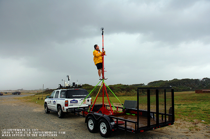
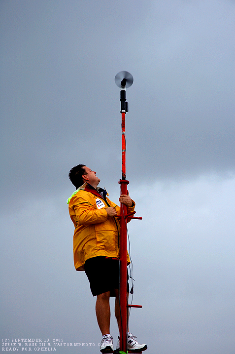
Here in these two photos, Mark is putting the anemometer in place and making sure everything is secure on the windtower.
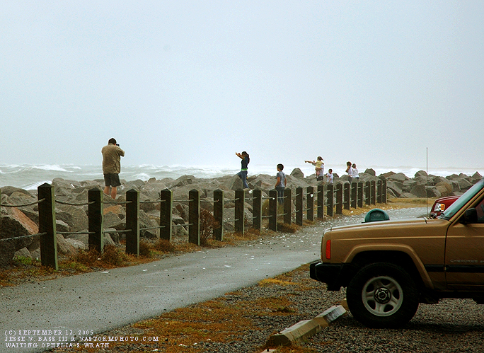
People out checking on the ocean and waves as photographers for newspapers grab a quick shot.
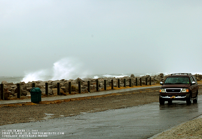
Waves smash the rocks along Forth Fisher as people start heading indoors as the winds and rain continue to increase.
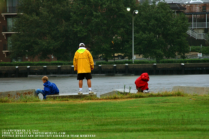
Mark's two oldest boys wanted to see what a hurricane is all about, so he took them down to the river and let them feel the wind and the rain for a bit before heading home.
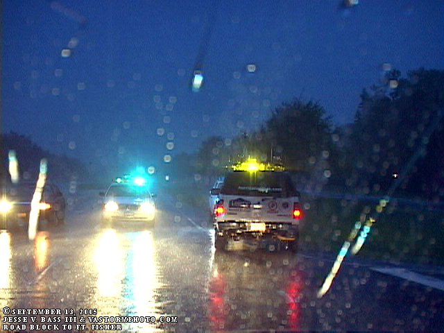
In this video frame grab, you can see the road block where we were trying to get back out to Fort Fisher where the wind tower was set up and recording data. No such luck this time though.
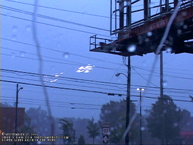
As we headed to Wrightsville Beach, we saw this power line arching in the wind as they touched each other.
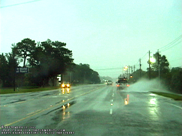
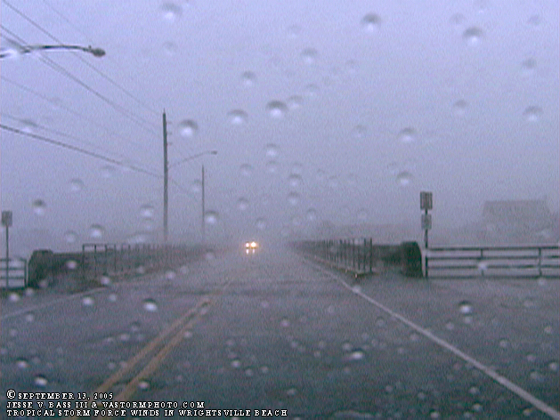
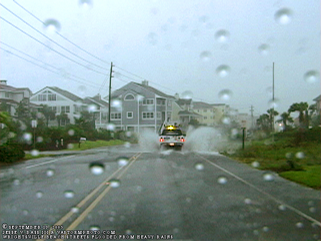
In this shot, Mark is ahead of me as we continued to head to the Wrightsville Beach area and you can see what Ophelia's heavy rains were doing to the area. Streets were flooding and making driving tricky if you were not careful.
As we approached the Wrightsville Beach area, the rain was coming in sheets and the wind was in the 40's in gusts.
And as we drove around the area, roads were flooded all along the Wrightsville Beach area.
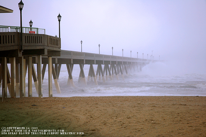
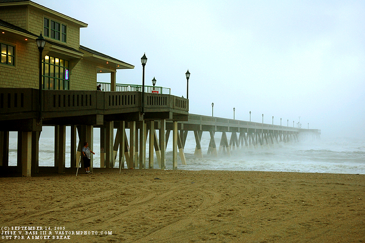
Next morning, Wednesday- Ophelia's
eyewall started coming ashore over Wrightsville Beach. These two photos were
taken at the Johnny Mercer Pier as the wind was driving the waves and spray
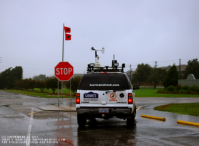
through the pier. One gentleman stepped out for a quick smoke. At the Wrightsville Beach Town Hall, the Hurricane Flags were flying and we stopped for a photo op.
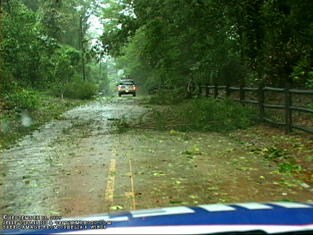
As we headed back to Wilmington and Leland to get ready for out trip northward, we saw along one stretch of roadway, downed tree limbs and a lot of leaves that had been blown off in Ophelia's strong wind gusts.
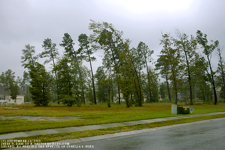
Back in Mark's neighborhood, Ophelia's winds were being felt as trees were bending to her power.
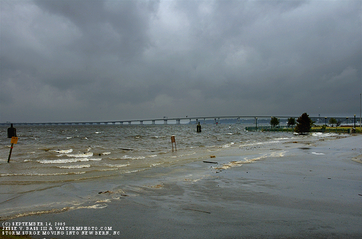
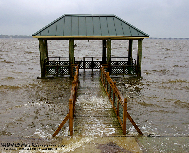
Once to New Bern, we stopped by the Comfort Suites Hotel to shoot some of the rising tide.
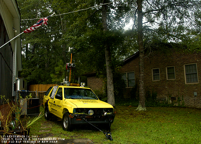
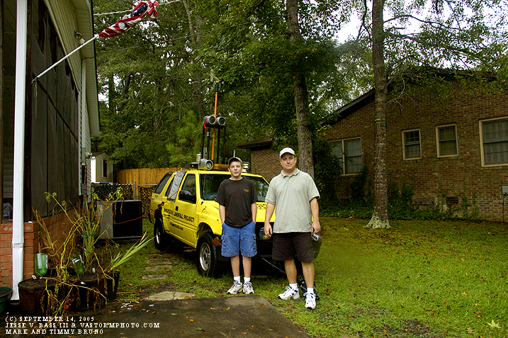
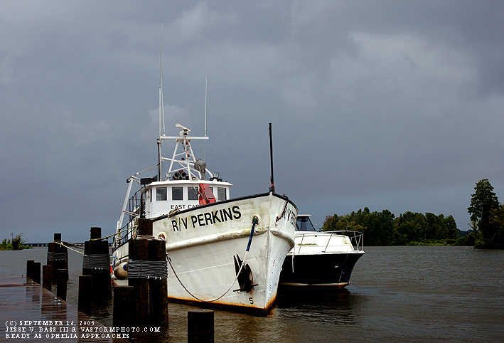
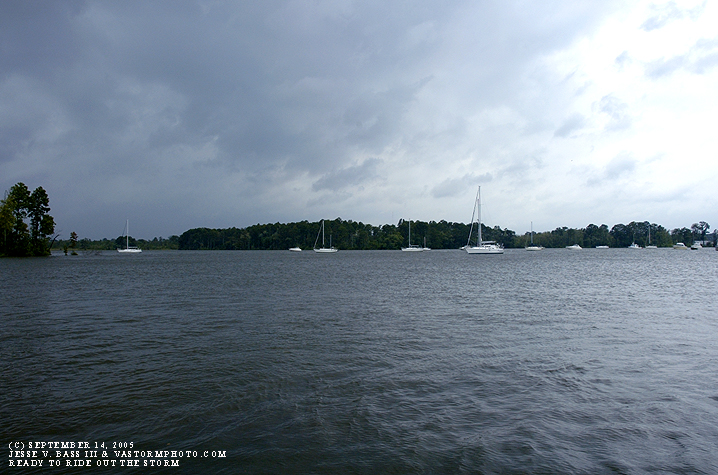
Here you see the old HLP vehicle, the Isuzu Rodeo and it's new owner- now fifteen year old Timmy Bruno. Boats moored and ready for the approach of Ophelia in New Bern, North Carolina
Here are more boats anchored and ready for Ophelia in New Bern as you see Ophelia approaching from the left side of the photo.
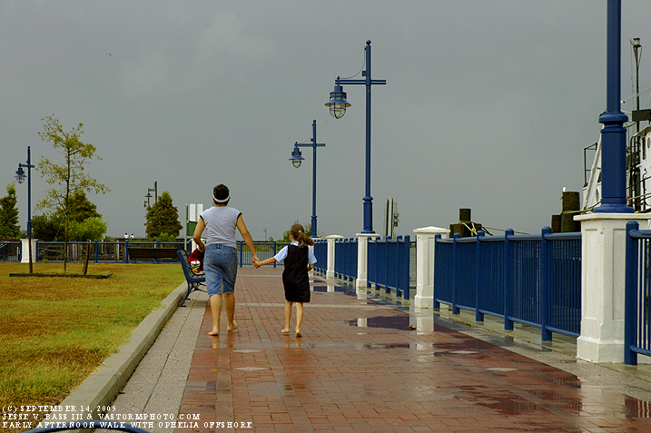
A mother and daughter walk along the boardwalk in New Bern with umbrella in hand as if Ophelia was just a rain shower. From here, we set our sites to the north and east towards the Outer Banks and the Nags Head and Cape Hatteras area as this would be the second landfall point for Ophelia. As we soon saw, we should have stayed in New Bern and the surrounding area.
|