|
|
|
|
|
MAY 29, 2004: TORNADO OUTBREAK CONTINUED!!
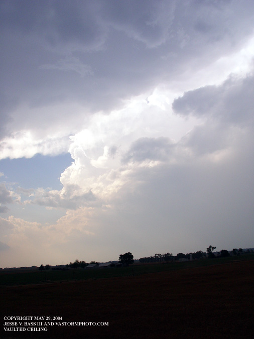
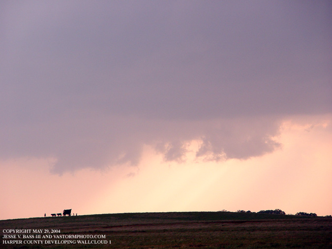
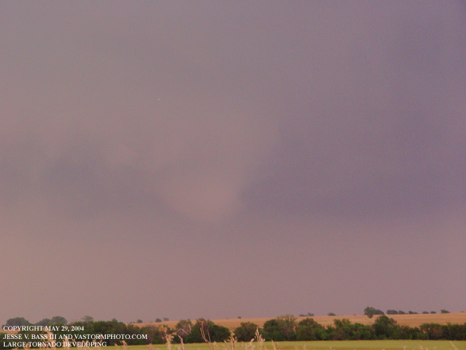
In the photo above, the supercell thunderstorm was starting to make its way into Harper County, Kansas.
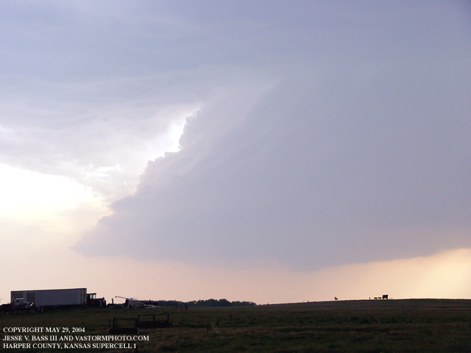
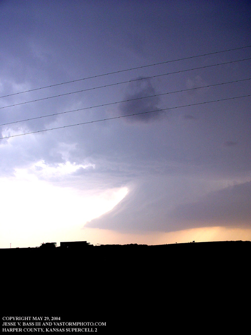
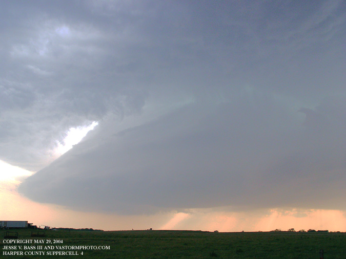
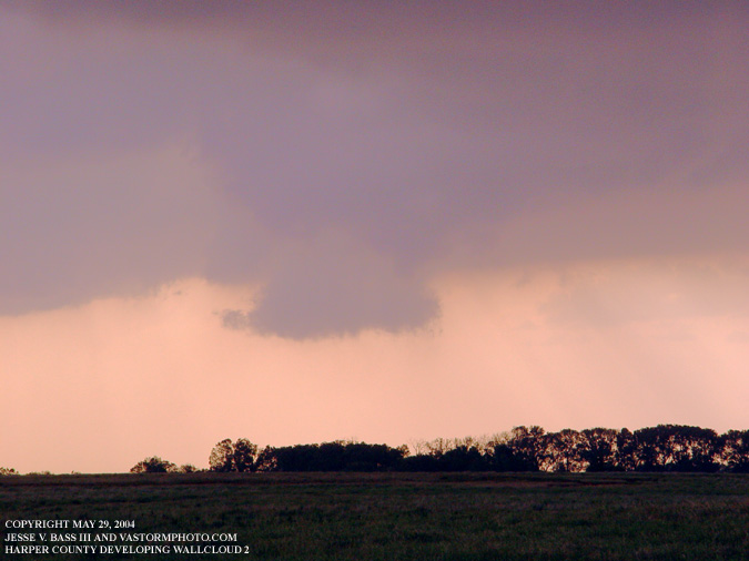
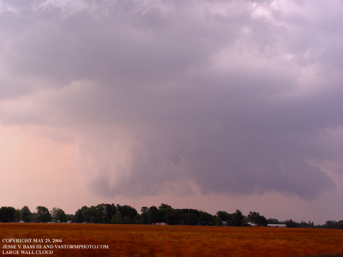
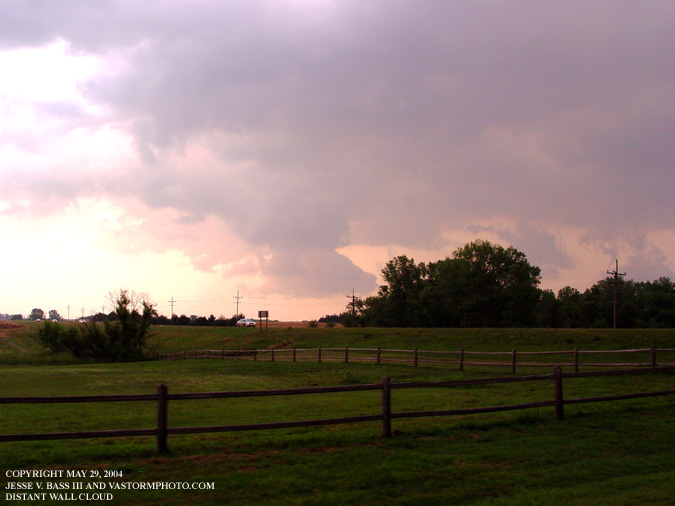
In these three photos, the supercell has moved into Harper County. It had really started to get organize had several wallclouds to form over several minutes. The wallclouds were ragged to start and then would re-organize. Then it really wrapped up.
Here are 2 shots of several of the wallcloud formations.
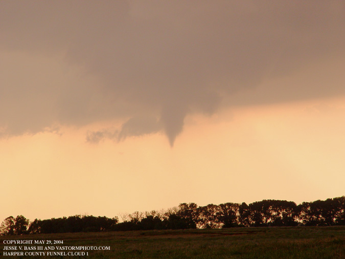
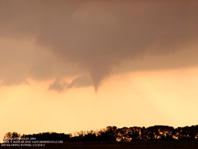
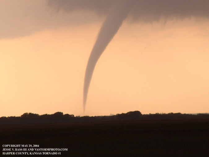
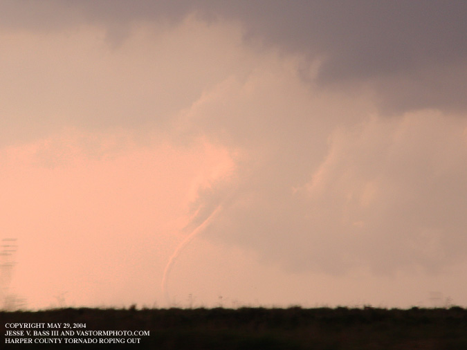
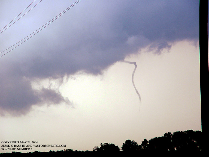
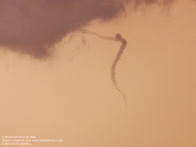
After about 15 minutes of watching the storm, a funnel started to descend from the base of the storm. The funnel started to drop several times from the storm but did not reach the ground. But on the third descent......
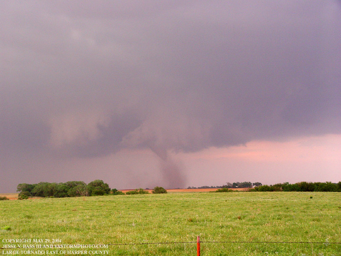
Once on the ground, The tornado started to move slowly off to the north.
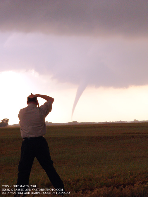
Caught in the act. Here John Van Pelt is using his new Nikon D70 to shoot away.
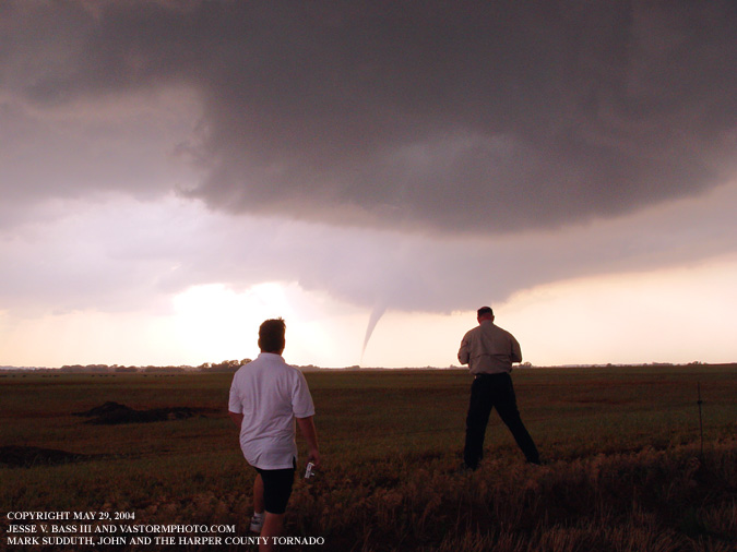
This was the first tornado for both, Mark and John. John had been out to the plains once a few years ago, and this was Marks first.
While we were watching the other tornado track north, a wallcloud formed over the road we were on and quickly moved east northeast. A few minutes later, a funnel started to drop to the ground.
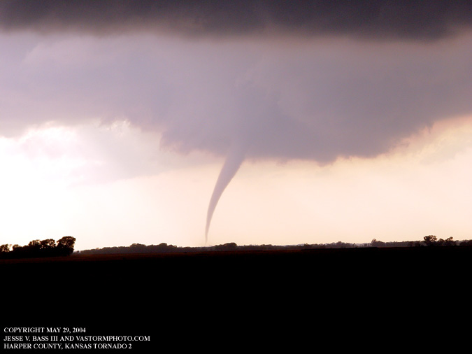
Here we were heading north quickly to get a better shot at both tornados. The first tornado started to rope out and die.
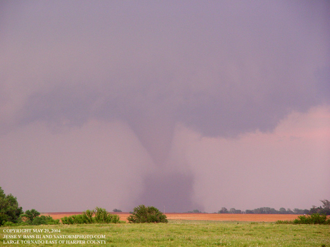
But here you can see this tornado was starting to increase in size as the died. This storm was headed in the general direction of Wichita.
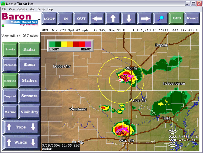
This tornado would quickly become the large wedge tornado headed towards Wichita, Kansas. This tornado was being tracked at the time by a local station KDFI FM.
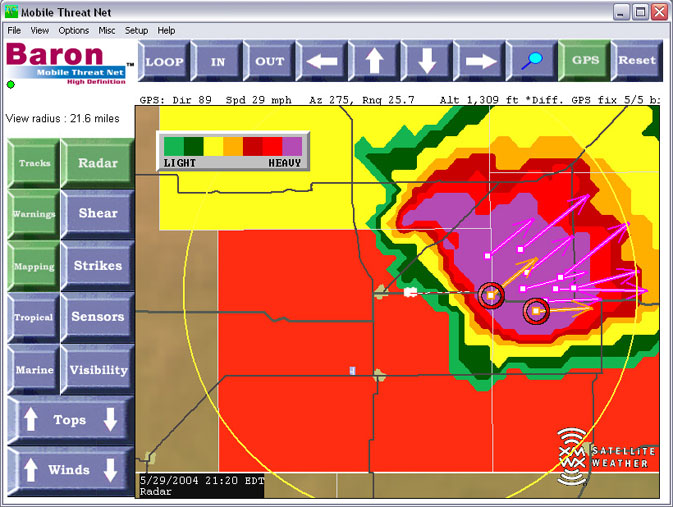
Here is a screen grab of the Mobile Threat Net in action. This is a large radar image of the large tornado that developed to our east. The little white image to the left of the tornado is our gps location. We were trying to head east on this road to catch up.
It was a ruff road trying to get to this storm again. Here we had to turn around and head back west due to roads being closed from the tornado knocking down power lines and trees. Further south, Dave Crowley, Dan Robinson and Keith Minor were on the Oklahoma City tornado. From talking to Dan and Keith at the time, this was another large tornado.
As we continued to try and catch up to the Wichita tornado, we had our third tornado develop in front of us. This small rope didn't last long. It briefly touched the ground and dissipated.
This massive wallcloud looked like it was going to drop another monster tornado. But it quickly started to fall apart. There were alot of chasers along this road watching this one. All of us that were cut off from the Wichita storm that is.
And yet another wallcloud that started to develop but did not produce.
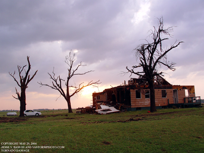
Unsure if this happened on the 29th or in the days before.
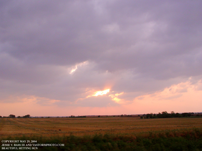
Beautiful sunset over the plains after several large tornados ripped through the area.
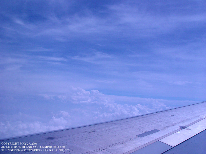
On the flight home, we could see some storms building near Raleigh, NC.
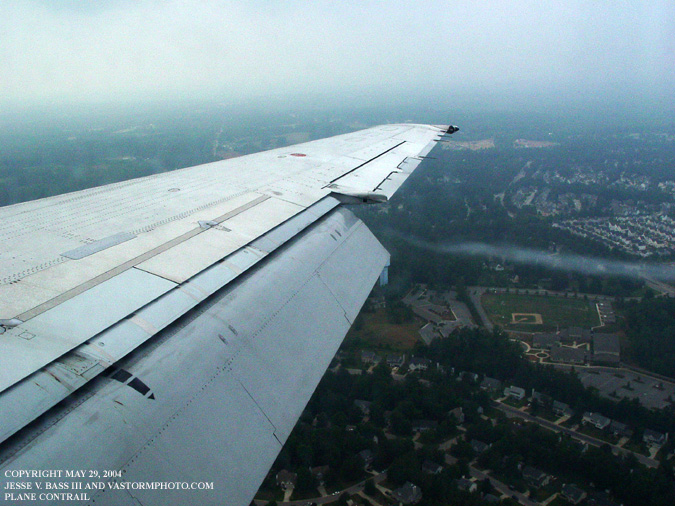
And a shot of us coming out of the cloud deck into the Raleigh area. We managed to pull it off. We left the airport in Raleigh Saturday morning and arrived in Kansas City around 10:30 am cdt. Drive south and see 4 or 5 tornados (3 here in digital photos, the others on video) and fly back home the next day. We drove a total of 663 miles round trip in Kansas. This may not have been possible if it had not been for the help of Dan Robinson and Keith Minor helping us to get the forecast area info on the best spot to be. Mark did a great job navigating using the limited GPS street maps and picking the initial target area on Thursday night, and John doing some incredible driving. And with the Mobile Threat Net in the car, it worked incredibly well. We were able to have up to date radar in an area where there were no digital cell phone signals for internet data. It just continued to work in all the remote areas of the plains. Plus, the shear marker feature let us keep a better eye on where any rotation may have been in any of the storms. It pegged all of our tornados right on the money. It is a great tool to have and it certainly helped to keep us safe. Back To Home Page 
All Images Copyright Jesse V. Bass III and VaStormphoto.com |